Geology
No stone unturned – A brief geological introduction
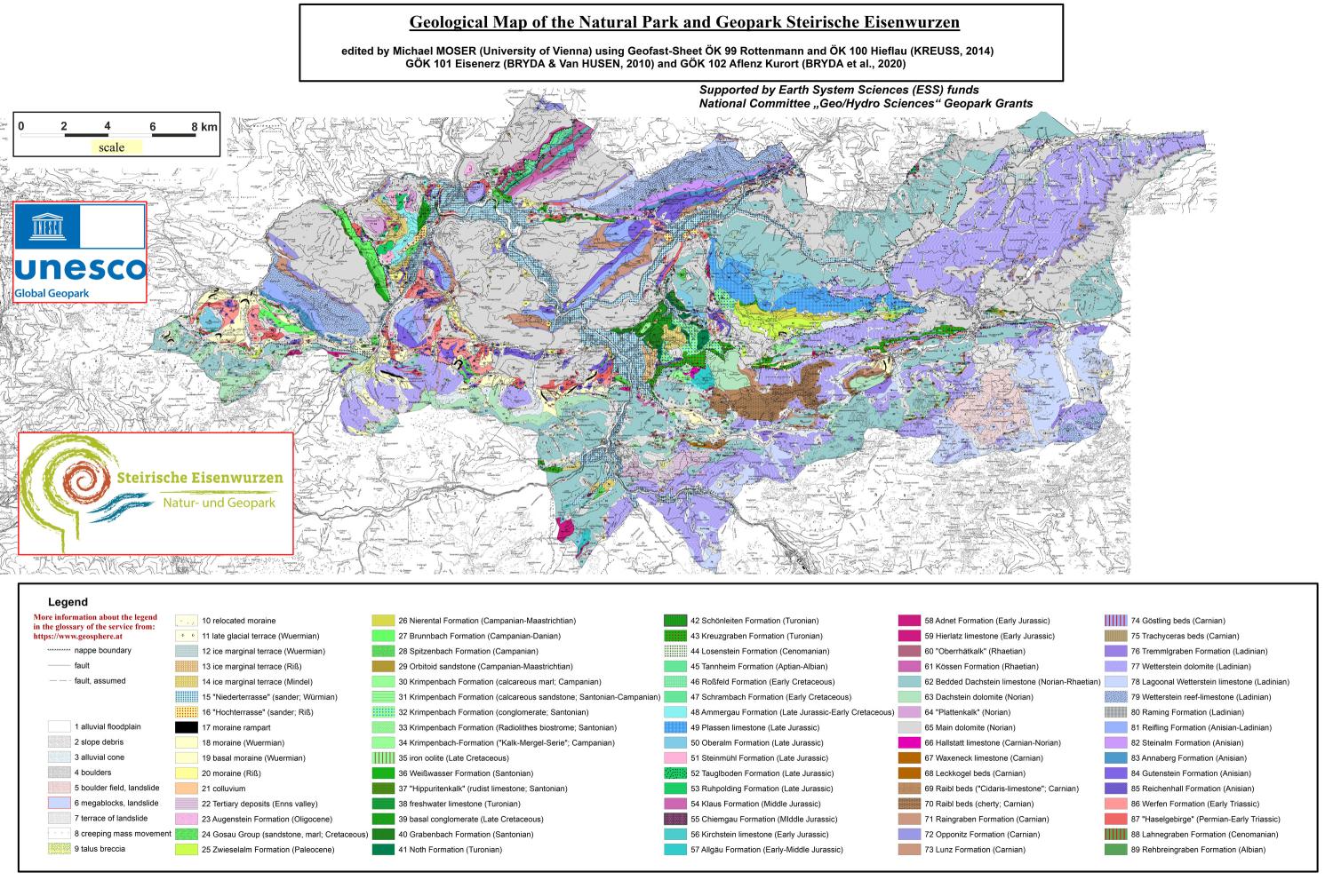
The Steirische Eisenwurzen Nature and Geopark lies entirely within the Northern Limestone Alps. The rocks found here are mostly from the Mesozoic. 253 million years ago, at the beginning of this age, there was a single vast continent called Pangea. The rocks of the Limestone Alps were formed on the edge of a huge bay on the giant continent.
Claret: Hard as glass
240 million years ago, the sea flooded the beach and lagoon landscape. This started the deposition of limestone and dolomite, the predominant rocks of the Limestone Alps. One of the oldest rocks is the Reiflinger Kalk, named after the occurrence of Großreifling in the Nature and Geopark. The irregularly shaped, dark gray cherts in the limestone are characteristic. They originated from the dissolved pebble skeletons of radioactive animals and sea sponges.
Lime and dolomite: The backbone of the Limestone Alps
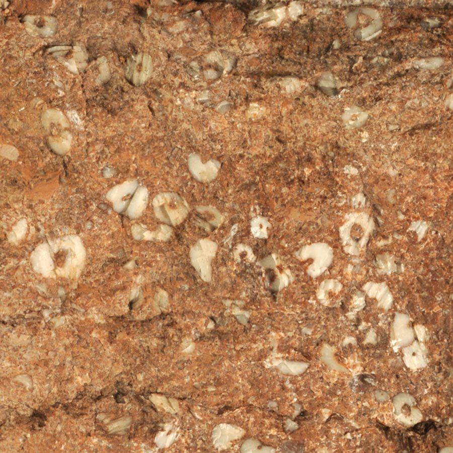
Throughout the Triassic, the sea floor was lowering. It was only a fraction of a millimeter a year, but for the whole 45 million years. Despite this, the sea did not get any deeper, because the deposits of limestone residues from algae and sea creatures compensated for the sinking. 205 million years ago, with the Jurassic, the disintegration of the giant continent began. Deep and shallow sea sections now alternated and the rocks deposited there are correspondingly different. In the Nothklamm in Gams, red limestone with countless remains of sea lilies, animals related to starfish and sea urchins, follow immediately above the Dachstein limestone.
Birthday of the Alps
It sounds paradoxical, but the Alps owe their formation to the progressive disintegration of the large continent. With the lifting of the Alps, the Limestone Alps, together with the greywacke zone, began to slide towards the north and north-east. Still covered by the sea, the Limestone Alps stretched far beyond the edge of Ur-Europe. The Limestone Alps were broken up into more or less large sections, which often pushed on top of each other for kilometers. These are the famous “covers” of the Alps. One of these nappe boundaries is on the northern edge of the Gesäuseberge.
Sand and Clay
135 million years ago the next phase of the earth’s history began, the Cretaceous period and with it the rise of the Alps above sea level. An island landscape developed in the south of the Limestone Alps 90 million years ago. At that time, the Limestone Alps were still slowly sliding northwards. Parts of it rose while others slowly lowered. Sand and clay accumulated in sinking parts of the mountains. One of these reservoirs is that of Gams.
Ice Age
The Ice Age, which began around 800,000 years ago, had a major impact on the landscape. At the end of the glaciers, the ice melted and rivers and streams sprang up. They washed away huge amounts of rock debris that snowed out from the glacial ice. Where the current slackened, they were deposited as gravel and filled the entire width of the valley. Lime deposits solidified the gravel into a conglomerate. Since the end of the Ice Age 12,000 years ago, the rivers have cut their valleys deep into the conglomerate. Its edges, which are flat on the surface and drop steeply to the river, form the terraces that extend in the Ennstal from Hieflau to Großraming in Upper Austria and in the Salzatal from Fachwerk to the mouth at Großreifling.
Literature:
- Bryda, G., D. van Husen, O. Kreuss, V. Koukal, M. Moser, W. Pavlik, H.P. Schönlaub, M. Wagreich (2013). Explanations on the geological map of the Republic of Austria 1:50,000, sheet 101, iron ore, 223 pp. Geological Federal Institute Vienna
- Husen, D. van (2000). Austrian Geological processes during the Quaternary. Announcements of the Austrian Geological Society, 92 (Aspects of Geology in Austria), 135 – 196.
- Kollmann, HA (1998). geology of the municipality. In: My homeland. Local history book of the municipality of Gams: 22 – 30
- Kollmann, HA (2009). A Review of the Geology of the Late Cretaceous-Paleogene Basin of Gams (Eastern Alps, Austria). In: The K/T boundary of Gams (Eastern Alps, Austria), A.F. Grachev, Ed. Papers of the Geological Federal Institute 63: 9 – 13


